| |
Teacher
Logbook:
Friday, July 28, 2000
Mary Beth's
Observations
The weather is
absolutely beautiful out at sea today. The sun is shining with only a
few clouds in the sky. We are still continuing our research over the Cleft
segment. The CTD is busy in a tow with mores casts and tows scheduled
for this evening. The students are busy helping to paint parts of the
fantail of the ship, working in the galley and observing up on the bridge.
Carol and I have been busy exploring the ship, looking for interesting
pieces of equipment and instrumentation.
Today I feature the winch
and the winch house. The winch is the workhorse of this cruise. The CTD
is connected to the winch and lowered into the ocean for both casts and
tows. You can think of the winch as a really big fishing rod with the
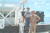
CTD connected at the end. In the picture you can see the black winch to
my left and the white winch house is to my right. Members of the ship's
crew operate the winch. They man the winch house for four hours at a time.
The winch has a coil of cable measuring 10,000meters long. The cable is
a special conducting cable, allowing scientists to acquire real-time data
while the CTD is in the water. Of course, the ship is prepared with a
back-up winch and cable in case there are any problems.
Who is that standing by
the winch with me? Say hello to Executive Officer George White. He was
up inspecting the winch while Carol and I took picture
Carol's
Observations
TWe are having sunny weather today. The brilliant blue sky has a few small,
fair weather cumulus clouds overhead. There are also some higher level
cirrostratus clouds. It is definitely a beautiful day at sea. This day
made me wonder how the ship tracks the weather. To find the answer I headed
to the top of the ship where the bridge is located. Junior Officer Cathy
Martin was on duty and willingly satisfied my curiosity.
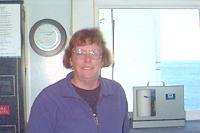
Cathy escorted me around
the bridge as she described the instruments. The ship has a rain gauge,
thermometer, wet and dry bulb thermometers, anemometer and wind vane to
gather the weather data. A weather report is taken every 6 hours when
the ship is 200 miles or more from the coast. Less than 200 miles a report
is taken every 3 hours. The weather report includes the time, position,
present weather, visibility, wind direction and speed, sea waveheight,
swell direction and height, seawater temperature in degrees Celsius, sealevel
pressure, and temperature for wet and dry bulb thermometers.
The ship's lead technician,
Russ Eastman, downloads NOAA weather products. There is a 24-hour and
72-hour prediction as well as a 48-hour analysis. These reports are posted
on the bridge for all to see. The weather 200 miles off the coast of Oregon
is definitely different from what we experience at Jamestown High School
in Williamsburg, Virginia.
Join me tomorrow to find
out if the sunny weather continues.
|
|

Mary Beth and the "XO"
inspecting the winch.

Carol on the bridge at the barometer station.

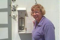
Enjoying the weather
outside and taking a temperature.
|
|

