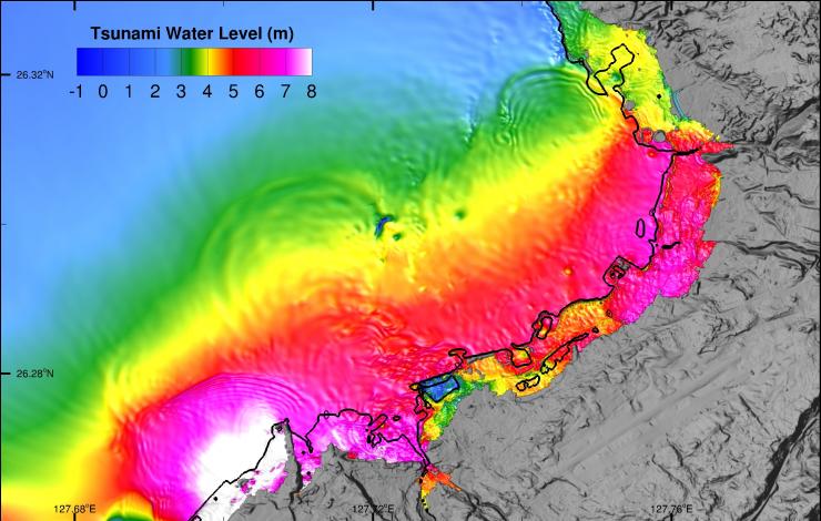
The University of Washington and NOAA Center for Tsunami Research at PMEL recently conducted a study for Department of Defense (DOD) overseas sites to ensure compliance of tsunami inundation modeling with recently established standards and guidelines by the American Society for Civil Engineers (ASCE). This update helps assess tsunami hazard at DOD facilities and identifies compliant design parameters for construction in tsunami hazard zones.
An extensive modeling effort for 23 Navy sites in the Pacific established detailed tsunami hazard zone maps in coastal areas and provided modeling data for building design guidance for tsunami-resistant buildings within the hazard zones.
No design criteria had existed in U.S. to address tsunami loads and effects on buildings before 2016. This work followed the new and first guidance from the American Society for Civil Engineers (ASCE 7-16)established in 2016, for constructions in tsunami hazard zones. The guidance requires establishing the hazard maps for the 2,500-year tsunami event, consistent with the National Seismic Hazard Maps, using probabilistic methods. This approach required intensive modeling efforts including hundreds of simulations with very high-resolution models for sources from areas prone to earthquakes that may trigger tsunamis, including the Ryukyu, Japan-Kuril, Mariana and Alaska-Aleutian trenches.
This project is funded by Navy Facilities and the National Institute of Building Science.


