RECCAP - surface
Regional Carbon Cycle Assessment and Processes
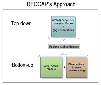
The Global Carbon Project has initiated an international synthesis activity called the Regional Carbon Cycle Assessment and Processes (RECCAP) aimed at combining evaluations of the atmosphere, land, oceans and humans to develop a global carbon balance. The project hopes to establish mean carbon balance estimates at the regional scale, a comparison of top-down and bottom-up flux estimates and evaluation of regional ‘hot spots’ of carbon flux activity.
The goals of RECCAP are to provide higher spatial resolution of the global carbon balance which will allow scientists to improve process attribution and identify regions essential to understanding the future evolution of the carbon cycle; to address a growing demand for a capacity to Measure, Report, and Verify (MRV) the evolution of regional fluxes and the outcomes of climate mitigation policies; to support capacity building in regions with regional carbon balances of significant global influence but with little or no technical capabilities; and to respond to the Group on Earth Observations (EOS) in establishing a global carbon observatory to track the evolution of natural and anthropogenic carbon sources and sinks.
The PMEL carbon group is contributing primarily to the ocean component of RECCAP by providing both surface and ocean interior observations. The available observations are localized and widely separated in both space and time, so we depend heavily on models to characterize, understand, and predict carbon fluxes at regional or global scales. The results from models differ from each other because they use different approaches (forward vs. inverse), modeling strategies (detailed process, statistical, observation based), process representation, boundary conditions, initial conditions, and driver data. RECCAP will provide an approach for identifying the causes of differences and deciding on which formulations and approaches best align with measurements, and why they may or may not agree with measurements.
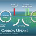
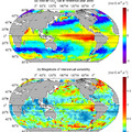
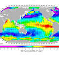
Two approaches have been used to understand ocean carbon uptake and storage. One approach is to assess ocean carbon inventory changes in the ocean interior. This is accomplished by reoccupying ocean sections that were surveyed during the 1990s. This work provides information on the decadal scale changes in ocean carbon storage. The second approach is to estimate air-sea CO2 fluxes. Surface ocean and atmospheric CO2 partial pressure is measured from ships of opportunity and moorings. These data are used to develop empirical relationships with properties that can be observed from satellites. Using the time and space coverage of the satellite observations we can generate global fluxes at monthly to decadal time scales. Both the surface observations and the ocean interior observations are used to better understand the controls on the ocean’s role in the global carbon cycle.
Air-sea flux estimates:
- Basic data: sea-air CO2 flux at monthly over the original grid of estimate, for 1990-2008. Units of mol m-2 y-1.
- Additional data: grid, pCO2, SST, wind speed, data statistics (number of data per grid point, variance etc), atmospheric pCO2.
- Metadata: pCO2 measurement technique, gas exchange model, method to interpolate data.
Ocean models will be used to test the impact of climate change on the air-sea CO2 fluxes, and to project the oceanic CO2 sink into the future. The reliability of the models can be determined by the examination of the CO2 fluxes over the historical period and their comparison with atmospheric and oceanic inversions and in situ data. Oceanic inversions will also provide estimates of CO2 fluxes based on the distribution of passive tracers in the ocean that can be compared to the in situ data.

