A20-2012
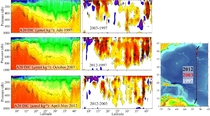
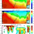
A hydrographic survey consisting of CTDO (conductivity, temperature, pressure, oxygen), LADCP (lowered acoustic Doppler current profiler), rosette water samples, underway shipboard ADCP and total carbon dioxide (TCO2) measurements was conducted in the western North Atlantic Ocean and Caribbean Sea aboard the UNOLS vessel R/V Atlantis from 24 March - 17 April 2012. A total of 81 CTD/LADCP/rosette stations were occupied on a transect running roughly along meridian 66°W. CTD casts extended to within 10 meters of the seafloor and up to 36 water samples were collected throughout the water column on each upcast. Salinity and dissolved oxygen samples, drawn from each bottle on every cast, were analyzed and used to calibrate the CTD conductivity and oxygen sensors. Water samples were also analyzed on board the ship for nutrients (silicate, phosphate, nitrate, nitrite), total CO2 (TCO2), pH, total alkalinity, and transient tracers (CFCs, SF6 and CCl4). Additional water samples were collected and stored for analysis onshore: dissolved organic carbon (DOC), 3Helium / tritium, 13C / 14C and black carbon. Underway measurements included surface total CO2, temperature, conductivity, dissolved oxygen, fluorescence, various meteorological parameters, and bathymetry.
Carbon Data
CTD and other hydrographic data
Section designation: A20
Chief Scientist: Dr. Michael McCartney and Dr. Donglai Gong
Dates: APR 19 to May 15, 2012
Ship: R/V Atlantis
Ports of call: Bridgetown, Barbados - Woods Hole, Ma.
Number of stations: 81
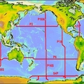
Geographic boundaries: 43.105°N to 6.868°N by 53.4795°W to 50.731°W


