Activity
#3: Contour Profiling

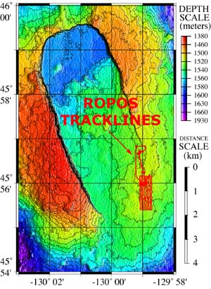
Map showing ROPOS tracklines.
Next, by maneuvering ROPOS back and forth in a grid pattern, we can produce a new bathymetric map of the area to look for changes in the seafloor terrain. Through a technique called contour profiling, we can create cross-section profiles of the seafloor along a given line. By comparing PRE- and POST-event contour profiles we can determine the extent of the new lava, its depth, and identify the collapsed areas. This will give more clues about what happened to the rumbleometer.