Twanoh
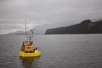
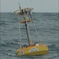
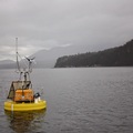
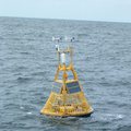
NANOOS ORCA buoy at Twanoh (47.37°N, 123.01°W)
Puget Sound has experienced significant anthropogenic impacts, including issues associated with invasive species, pollutants, and significantly altered freshwater, acid deposition, nutrient run-off, and sediment contamination as a result of the approximately five million people living in the watershed. These impacts need to be studied to better understand how the Sound and its many ecosystem services might change in the future. Data from autonomous buoys help us to see how variable water properties are and thus what properties might be affecting them. Hood Canal is a long narrow estuary on the western side of Puget Sound. It receives river and groundwater input, is only connected to the Sound at the northern end, and flushes relatively slowly. Chemical properties of the waters in this estuary are subject to fluctuations over a range of time scales from hours to years.
Hood Canal has experienced problems with low dissolved oxygen, resulting in fish kills that have occurred with increased frequency. It is the site of the Hood Canal Dissolved Oxygen Program study. Twanoh is located in Lower Hood Canal, where oxygen is characteristically the lowest. Hypoxia and ocean acidification may have synergies that are especially stressful to organisms.
A MAPCO2TM system was installed on an Oceanic Remote Chemical Analyzer (ORCA) buoy at the southern end of Hood Canal, near Twanoh, on August 22, 2009 as a collaborative effort between PMEL's carbon group and University of Washington's ORCA Group . This buoy is part of the NANOOS network. The Oceanic Remote Chemical Analyzer (ORCA) is an autonomous moored profiling system providing real-time data streams of water and atmospheric conditions. It consists of a profiling underwater sensor package with a variety of chemical and optical sensors, and a surface mounted weather station, solar power system, winch, and custom computer and software package equipped with WIFI/cellular communication. Please visit the ORCA website for more Twanoh buoy information and other sensor data.
Finalized Data availability: National Centers for Environmental Information NCEI.

