Heron Island
Heron Island (22.46°S, 151.93°E)
Heron Island is a 20-hectare coral cay, 65km east of Gladstone, at the southern end of the Great Barrier Reef. Half of the island is a national park, one quarter is the University of Queensland Research Station and one quarter is a resort. The island is situated on the leeward (western) side of Heron Reef, a fringing platform reef of significant biodiversity, supporting around 900 of the 1,500 fish species and 72% of the coral species found on the Great Barrier Reef.
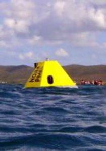
A MAPCO2TM system was deployed off Heron Island on October 10, 2009. This site was established to monitor ocean acidification in sensitive coral reef environments through a joint effort between PMEL and the CSIRO Marine and Atmospheric Research, Australia. This site is currently operated by CSIRO, in addition to other coastal ocean acidification buoys around Australia.
Finalized Data availability: see Australia's Integrated Marine Observing System.
The plot below is not currently maintained by PMEL. For more recent data plots, please see the Global Ocean Acidification Observing Network.


