First Landing OA
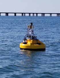
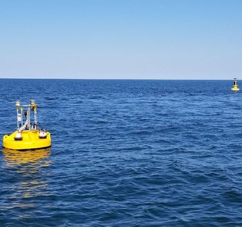
Chesapeake Bay Interpretive Buoy System Ocean Acidification Buoy at First Landing (37°N, 76.1°W)
Chesapeake Bay is the largest estuary in the United States and its watershed is home to nearly 18 million people. Once one of the most productive oyster growing areas in the world, overfishing, loss of habitat, and eutrophication have degraded the ecosystem. Restoration efforts established in the 1980s seek to improve bay health through reducing nutrient runoff, restoring habitat, and managing fisheries. However, ocean acidification (OA) has become another stress to the Bay with unknown consequences. Recent studies in coastal systems show that eutrophication exacerbates OA by enhancing respiration of algal biomass at depth, which reduces oxygen levels (i.e., hypoxia) and increases CO2. OA may be particularly acute in Chesapeake Bay, where lower buffering capacity may lead to more rapid acidification compared to the open ocean. This Chesapeake Bay mooring will document the status and progress of OA and contribute to our understanding of its drivers and impacts in this important ecosystem.
The Chesapeake Bay First Landing buoy was established in April 2018 in collaboration with NOAA Ocean Acidification Program (OAP), NOAA PMEL, U.S. IOOS Mid-Atlantic Regional Association Coastal Ocean Observing System (MARACOOS), and the University of Delaware (UDel) is to produce high quality data and models to monitor the Chesapeake Bay. The new buoy is located beside the First Landing Chesapeake Bay Interpretive Buoy System (CBIBS) site to maximize collaborations with existing research and observational efforts, leverage equipment assets, and integrate with ongoing ship-based surveys and outreach activities.
For data availability contact: adrienne dot sutton at noaa dot gov

